|
|
|
|
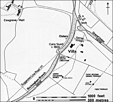
Fig 2 The immediate environment of the Cosgrove villa.
|
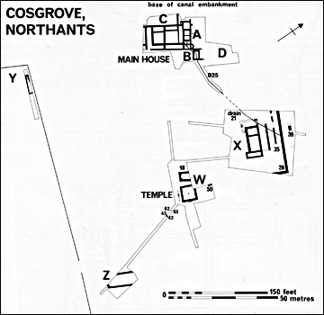
Fig 3 Cosgrove: location of Roman buildings and excavation trenches.
|
|
|
|
|
|
|
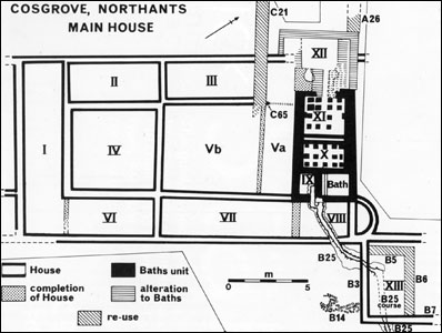
Fig 4 Cosgrove: the Main House Areas A-D.
|
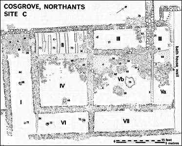
Fig 5 Cosgrove: Plan of the Main House Area C.
|
|
|
 Fig 6
Fig 6 Cosgrove: the Main House area C. sections.
|
|
|
|
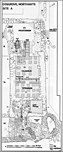
Fig 7 Cosgrove: plan of Bath House (Area A) within the Main House.
|
|
|
|
|
|
|
|
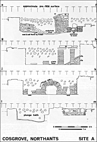
Fig 8 Cosgrove: Bath House (Area A), sections; subfloor infills removed
by C W Green.
|
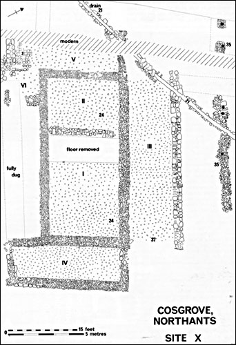
Fig 9 Cosgrove: plan of Building X.
|
|
|
|
|
|
|
|
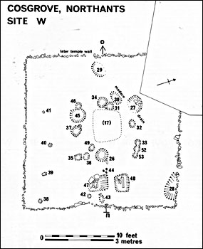
Fig 10 Cosgrove: plan of timber shrine Area W.
|
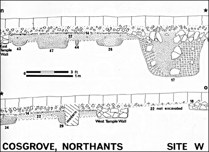
Fig 11 Cosgrove: Temple and timber shrine Area W, sections.
|
|
|
|
|
|
|
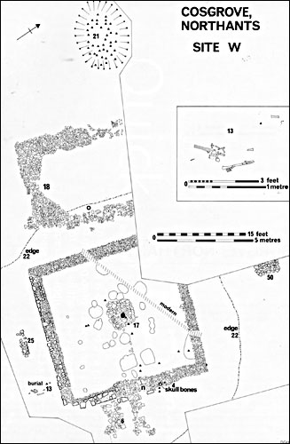
Fig 12 Cosgrove: plan of Temple Area W; features relating to the timber shrine
(Fig 10) shown in outline. Triangles indicate coin findspots.
|
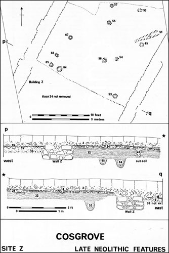
Fig 13 Cosgrove: Late Neolothic features Area Z; sections Area Z
|
|
|
|
|
|
|
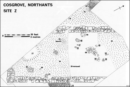
Fig 14 Cosgrove: Building Z; underlined features numbers sealed by floor 24.
|
|
|
|
|
|
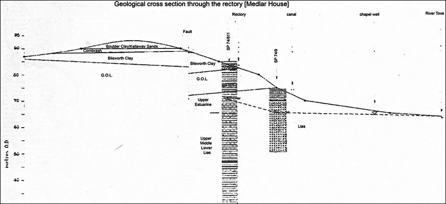
This geological cross section indicates a "chapel well" which we surmise might be the Temple well shown in Fig 3 above. The canal here is the Buckingham Arm.
|